

|
Menu
|
|
|
|||||||||||||||
|
|
|||||||||||||||
145
|
146 |
147 |
148 |
149 |
150 |
151 |
152 |
153 |
154 |
155 |
156 |
157 |
158 |
159 |
160 |
| The Plynlimon & Hafan Tramway. If you enjoyed Bob Prigg's photograph of the extraordinary Croesor Tramway in Photo Gallery 21, you will enoy this selection of photographs by Chris Parker of the almost as extraordinary Plynlimon & Hafan Tramway. This operation was a 2ft. 3in. tramway in Ceredigion (formerly Cardiganshire) which ran from Llandre (originally named Llanfihangel) on the Cambrian Railways' branch between Dovey Junction and Aberystwyth. The tramway had a very short life: it opened in 1897 to serve lead mines at Bwlch Glas and stone quarries near Hafan, but closed just two years later. From Llandre (about 5½ miles north east of Aberystwyth), it passed through Talybont and the valleys of the Afon Leri and Afon Cyneiniog to reach the foothills of Plynlimon Fawr; it was 7¼ miles long and even operated a short-lived passenger service, although it served no community of more than 100 people. Most of the track was lifted in 1914, although a section through Bwlch Glas Farm lasted until 1926. Chris writes: 'Nine of us us took part in this walk in early April 2011; the weather conditions were iffy at first but rapidly improved and were ideal for the final two thirds of the walk. A member's clearance work between the main incline foot and Bwlch Glas mine was very apparent and progress was much faster than on the recces.' The west end of the line traverses mainly private farmland and is not accessible, but things are different at the east end where part of the trackbed has become a public footpath or runs over open moorland. A further selection of photographs of this remote and rugged line can be found on the Geolocation website here and Simon Robinson's Plynlimon & Hafan Tramway site here. The history of the line is well documented in Grace's Guide. |
||
 |
||
| Above: The end (or start) of the oine at Hafan Quarry gives an indication of the extensive views available from this remote route. As can see, the area is used for forestry but – perhaps unusually for Wales – there are no sheep! 2nd April 2011. (Chris Parker) | ||
 |
||
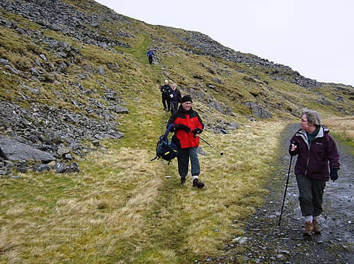
| Above: There were two inclines at the 'business end' of the line, this being the upper one. Wikipedia describes this as a 'mineral extension' leading from the top of the main incline to a 'granite sett quarry'. According to the Royal Commission on the Ancient and Historical Monuments of Wales, these setts were 'road setts' rather than the sleeper setts that one might have expected, so the quarry must have been making a contribution to local road building or improvements. 2nd April 2011. (Chris Parker) | ||
 |
||
| Above: A view of the main incline at Hafan, which can be found at approximately SN 733880. This is another one of those old lines which gives the lie to the notion that all old railways are flat and traverse dull scenery. 2nd April 2011. (Chris Parker) |
||
 |
||
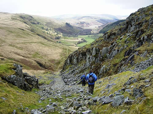
| Above: The view looking down Hafan Incline towards the valley of the Afon Cyneiniog, which can be seen in the distance. The views on this line really repay exploration. 2nd April 2011. (Chris Parker) | ||
|
||
 |
||
| Above: At the foot of Hafan Incline, the gradient on the trackbed eases off for a gradual descent into the valley of the Afon Cyneiniog. The views remain both extensive and impressive. 2nd April 2011. (Chris Parker) |
